
Getting here
From Panaji, take a taxi or rental scooter north on NH 66 toward Candolim, then follow signs for Sinquerim Beach / Aguada Fort. The nearest useful landmark is the lower Aguada complex.
Where laterite stone meets the Arabian Sea tide.
Welcome to Sinquerim Fort, widely recognized as the Sinquerim Beach Bastion. Located on the shoreline of Candolim, Goa, India, this sea-facing bastion is a primary stop for travellers reading the North Goa coast.
4.5 / 5 · · 20,252 Google Maps reviews
Rating & review count synced from Google Maps user reviews · September 2026 · View all reviews on Google Maps ↗
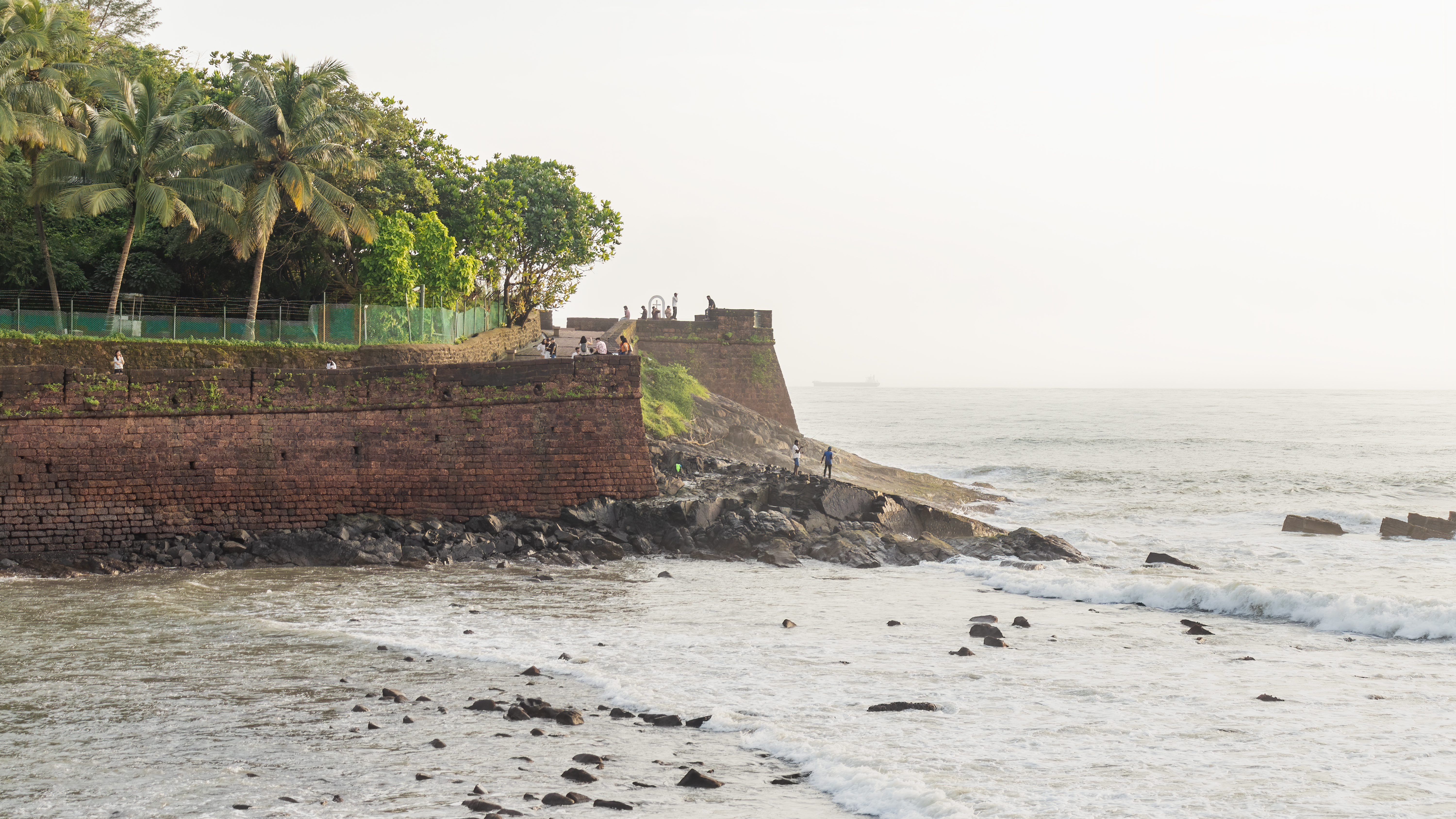
A small bastion, a wide horizon
Welcome to Sinquerim Fort, widely recognized as the Sinquerim Beach Bastion. Located in Candolim, Goa, India, this destination serves as a quiet hub for travellers visiting the region — the place where the Aguada defence line meets the open sea.
Built by the Portuguese in 1612 as part of the Aguada defensive complex, the lower fort once watched the mouth of the Mandovi River. Today its curved wall and causeway make a quiet lookout over Sinquerim, Candolim, Calangute and Baga.
Come for the architecture, stay for the changing light: warm laterite after rain, bright fishing boats at noon, and a horizon that turns copper before dusk.
Visitor sentiment
This is an unofficial guide. The score and review total are quoted from the Google Maps listing for Sinquerim Fort; the reviews themselves stay on Google and are not reproduced here.
4.5 / 5
20,252 Google Maps reviews
Synced from Google Maps user reviews, last synced September 2026; copyright belongs to the original authors and Google Maps. Shown on this page for reference only — the rating is not published in this site’s structured data.
View all reviews on Google Maps ↗The quiet rule
Let the wall stay between you and the sea.
The masonry is unguarded in places. Stay on the causeway, keep back from edges and leave the beach as you found it.
1612 → today
Sinquerim Fort was raised by the Portuguese in 1612 as the lower, sea-facing work of the Aguada defensive complex. Standing at the mouth of the Mandovi River, it watched the anchorage and the shore road that supplied the settlements of northern Goa.
Its significance is in the setting rather than the scale: a short laterite curtain wall, a causeway and a bastion that put cannon within range of the sea lane. Together with the upper fort and the lighthouse it forms the clearest surviving reading of how Goa’s coastline was defended.
Today the site is valued as public open space — an unhurried viewpoint where military architecture, fishing boats and the Arabian Sea share the same horizon.
Make it a good visit
From Panaji, take a taxi or rental scooter north on NH 66 toward Candolim, then follow signs for Sinquerim Beach / Aguada Fort. The nearest useful landmark is the lower Aguada complex.
Aim for early morning or the last two hours before sunset. Plan around 45–90 minutes; add time for the beach and upper Aguada Fort. The fort area is generally visited in daylight.
The bastion is commonly treated as a free outdoor viewpoint. Fees and access rules for the wider Aguada complex can vary, so check on arrival before planning a paid visit.
Use marked parking near the Aguada / Sinquerim approach where available. Do not block beach access, residential lanes or the fort causeway; scooters are easier than large cars in peak hours.
Pair the walk with Goan fish curry, poi bread, prawn balchão or a chilled kokum drink at the beach shacks and Candolim restaurants. Ask for the catch of the day rather than choosing by menu alone.
Bring water, sun protection, shoes with grip and a light layer for the sea breeze. Avoid climbing the walls; the stone is beautiful because it has survived the weather.
Build a half-day
When visiting Sinquerim Fort, visitors can easily explore surrounding historical landmarks and points of interest, including Aguada Fort & Lighthouse and Candolim Beach.
The upper chapter of the same coastal defense story, with wide Mandovi views and a distinct lighthouse silhouette.
Follow the sand north for a softer, busier stretch of coast with sunset shacks, water sports and seafood.
Across the river, another restored fort adds a quieter counterpoint to the Aguada shoreline.
Coordinates, not guesswork
FQX8+9HJ, Candolim, Goa 403515, India · 15.498447, 73.766356
Map data © Google. Search FQX8+9HJ, Candolim on Google Maps ↗
A few clear answers
Sinquerim Fort is located in Candolim, Goa, India, on the shoreline below Aguada Fort at Plus Code FQX8+9HJ (15.498447, 73.766356).
Yes, the sea-facing bastion is a public space and is generally free to view in daylight. Any paid access nearby belongs to other parts of the Aguada complex and may change.
The bastion is an open-air site usually visited between roughly 09:30 and 18:00. Hours are not formally ticketed, so confirm locally before an early or late visit.
Allow 45–90 minutes for the bastion, beach walk and photographs. Add more time if pairing it with Aguada Fort.
Early morning is cooler and quieter; late afternoon gives softer light over the laterite walls and the Arabian Sea.
Within a short drive you can reach Aguada Fort & Lighthouse, Candolim Beach and, across the Mandovi estuary, Reis Magos Fort.
Head north on NH 66 toward Candolim, then follow signs for Sinquerim Beach / Aguada Fort. Taxis, rented scooters and ride-hailing all work; scooters are easier to park in peak season.
Sources & attribution
Ratings & reviews · synced September 2026
Synced from Google Maps user reviews, last synced September 2026; copyright belongs to the original authors and Google Maps. Displayed on this page for reference only and not included in this site’s structured data.
View all reviews on Google Maps ↗Location & map data
Google Maps listing and Plus Code FQX8+9HJ, Candolim, Goa 403515, India (15.498447, 73.766356). Map data © Google.
Official tourism information
For official updates and regional tourism information, visit the Goa state tourism portal.
India / Goa Official Tourism Portal ↗Photography
Hero photograph: iMahesh, “Sinquerim Fort view point, Aguada”, CC BY-SA 4.0 via Wikimedia Commons.